Access Yes! is a program designed to improve access to private land or through private land to public land by compensating willing landowners who provide access.
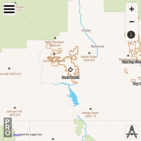
i-Hunting app includes Access Yes Properties hunt layer under Idaho -> Access Yes Properties. To enable this layer, please use the following taps:
|
|
Available Attributes for Access Yes Properties , Idaho
- Name
Available Access Yes Properties
- A L Cattle - Dodson Pass
- A L Cattle - Shirts Creek
- American Falls - Sunbeam Area
- Arbon - East Bench
- Arbon - North Valley
- Arbon - Southeast Bench and Central Farm Ground
- Arbon - South Valley
- Arbon - Southwest Bench
- Arimo Corp.
- Back Downata
- Basterrechea
- Bern
- Big Foot Bar Boat Ramp - Snake River
- Big Onion
- Bingham County, east of Firth, Blackfoot Mountains - Two miles west of Mt Taylor (Blackfoot Peak)
- Black Canyon
- Blackfoot River/Reservoir
- Bonneville County, Just south of Tex Creek WMA Between Bulls Fork and Willow Creek.
- Bulls Fork Ranch
- Caribou Creek Drainage
- Cliff Canyon
- Colorado Gulch Preserve
- Dan Creek-Jumpoff Hill
- Deer Park Creek West of Leadore
- Diamond A Livestock
- Diamond A Livestock - Little Pilgrim Gulch
- Dry Creek Cattle Assn.
- Dry Valley
- East of Ririe Reservoir/Meadow Creek Junction
- Erskine - Boise River Dixie
- Faulkner Land & Livestock
- Fish Creek Angus
- Flat Top Sheep Co.
- Fox Hills Ranch
- Genesee Area
- Guerry, Inc.
- Hammett Livestock
- Highland Land and Livestock - Boise River WMA
- Hillhouse Canyon
- Hugas Creek & St Joe River Basin
- Inkom - East Bench
- Janss Farms
- John Creek Drainage
- Kilgore Area
- Kirtley Creek, Lemhi River
- Lava Lake Land and Livestock
- Lazy "R" Ranch
- Marsh Valley
- McNabb Canyon
- Mica Creek Drainage on St Joe River
- Mink - East Pine, Advent Gulch, Weiser River
- Muldoon Grazing Assoc.
- Ninety Percent Canyon
- North Teton River
- Osborn - Indian Valley
- Osborn - New Meadows
- Osborn - Six Mile Crk
- Osborn - Six Mile Crk (Exceptions)
- Paddock Valley Reservoir
- Palouse River Upland Game Area
- Pat and Debra Woodworth
- Paul Schmidt
- Payne Family Grazing - Pleasant Valley and Thomas Creek
- Petersen Loop
- Pine Creek Bench
- Pocatello - 2 and 1/2 Mile Road
- Portneuf River
- Rock Creek
- Rockland
- Rockland Valley - Flint Canyon
- Rockland Valley - Hartley Canyon
- Rockland Valley - West
- Salmon River and Grave Creek
- Steve Deeg Farms
- Sundown Ranch
- Swan Lake
- Thomas Fork
- Tom Billington
- Trout Creek Drainage (Pack River)
- Trout Creek Drainage (St. Joe)
- Upper Lemhi Access Area
- Van Deusen Ranch - Willow Ridge
- Weatherly Property
- Weippe Area
- West of Waha and Miller Road - Ten Mile Canyon and Fields to the South
- Whitebird Hill and Joseph Plains/Boles
- Windy Wheat, LLC (Formerly Vernon Miller)
- Wolverine Canyon - East
- Wolverine Canyon South Property
- Wood River Land Trust - Cowcatcher Ridge
- Wood River Land Trust - Draper Wood River Preserve
- Wood River Land Trust - Porcupine Creek Preserve
- Wood River Land Trust - Rock Creek

