Cross Platform
* iOS (iPhone / iPad)
* Android (Phone /Tablet)
* Windows
* Web App
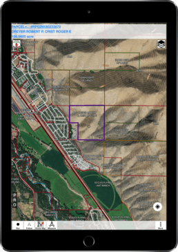
Land Ownership
* Unified US wide layer for parcels
* Additional attributes
- Owner name
- Owner address
- Total Value
Hunt Planning
* Hunting Areas
* Game distribution
* Hunt Zones / Districts
* Restricted Areas
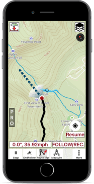
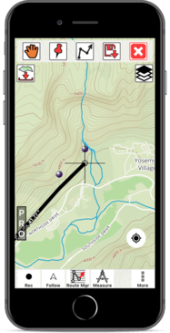
Vector topo maps
* Apply Elevation Offsets
* Customized Units
* High Quality data